 |
||||||||
| Issue Number 257 |
January
2001
|
|||||||
|
P.O. Box 189, Moffett Field, CA 94035-0189 |
||||||||
|
|
||||||||
|
||||||||
| Issue Number 257 |
January
2001
|
|||||||
|
P.O. Box 189, Moffett Field, CA 94035-0189 |
||||||||
|
|
||||||||
![]()
The Global Positioning System (GPS) is a worldwide, satellite-based radio navigation system that is based on several components – ground stations that control the system; a "constellation" of 24 or more satellites orbiting 11,000 miles above the surface of the earth; and receivers carried by users.
GPS signals are derived from the atomic frequency standards on board each satellite. When receiving the signals from at least 4 satellites, a ground-based receiver can determine latitude, longitude, altitude, and time – highly accurate information used by both air carrier and general aviation pilots. But GPS use also requires judicious cross-checking with cockpit charts and instruments, as well as knowledge of the technology’s limitations. Several ASRS reports explain:
ASRS frequently hears from pilots who "go direct" with GPS and neglect other flight planning. A quick look at a VFR chart, low altitude IFR chart, or the airport GPS approach plate would have helped this pilot differentiate between the location of the GPS fix and the airport location. The use of flight following, even with no flight plan filed, might also have prevented the airspace violation.
![]() Our
next reporter relied on a visual feature of GPS for navigation when
other features would have better served the purpose:
Our
next reporter relied on a visual feature of GPS for navigation when
other features would have better served the purpose: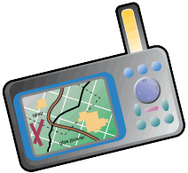
An additional factor past ASRS research has demonstrated leads to Class B airspace violations is flying too close to the floor (or ceiling) of Class B airspace. ATC often uses the floor/ceiling altitudes to route IFR air carrier flights transitioning to or from the airport terminal area. Safer practice is to maintain an appropriate VFR altitude buffer between the aircraft and Class B floor/ceiling altitudes.
![]() Another
pilot reported that he used GPS successfully to navigate to a distant
point on an IFR flight plan – but ran afoul of the FARs in the
process:
Another
pilot reported that he used GPS successfully to navigate to a distant
point on an IFR flight plan – but ran afoul of the FARs in the
process:
IFR equipment rules apply to all conditions under which instrument flights may be made, including CAVU. According to Section 5-1-7(a)3 of the current Aeronautical Information Manual, the /A notation on an IFR flight plan indicates that the aircraft has transponder with Mode C capability only. The /G notation indicates that the aircraft is GPS/GNSS equipped with enroute, terminal, and approach GPS capability.
The reporter erred twice – in requesting a route short-cut using VFR-certified GPS on an IFR flight plan; and in accepting the Center controller’s reroute to the distant fix. The Center controller in this case should not have approved the direct reroute, since the pilot legally should have had IFR-certified GPS on board in case radar coverage was lost.
![]()
CALLBACK
has published stories in past issues about aircraft that took off
with a tow bar or tail stand attached. Here’s a similar report
filed by the pilot of a helicopter air ambulance flight: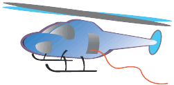
![]() Professional
helicopter pilots spend many hours honing the skills needed to perform
confined area landings and takeoffs. These skills are crucial to
the completion of many helicopter missions. Pilots in a multi-crew
helicopter operation often used ground observers to help judge clearance
from wires and other hazards to spinning rotor blades. But at times
even this precaution is not enough to prevent an incident, as the
pilot of this aerial photography mission discovered.
Professional
helicopter pilots spend many hours honing the skills needed to perform
confined area landings and takeoffs. These skills are crucial to
the completion of many helicopter missions. Pilots in a multi-crew
helicopter operation often used ground observers to help judge clearance
from wires and other hazards to spinning rotor blades. But at times
even this precaution is not enough to prevent an incident, as the
pilot of this aerial photography mission discovered.
![]()
The November 2000 CALLBACK (#255) included an article on wake vortex hazard at cruise altitudes. This article cited 131.8 MHz as the aircraft-to-aircraft communications frequency used on North Atlantic routes in conjunction with Reduced Vertical Separation Minimum (RVSM) air traffic procedures. We heard back from several alert readers that the 131.8 MHz frequency is no longer in use.
ASRS has verified with ATC sources that 123.45 MHz is the aircraft-to-aircraft communications frequency now in use on most North Atlantic routes under RVSM procedures – except the West Atlantic Route System (WATRS), which is still using 131.8 MHz. Thanks to our readers for bringing this change to our attention.
|
ASRS
Recently Issued Alerts On...
|
|---|
| B757-200 power port converter electrical short |
| Multiple reports of ATC incidents at a major NY airport |
| A319 pitch-up on approach with engines in auto throttle |
| Laptop computer interference with B767 cabin speakers |
| Bulb replacement anomaly involving a SF340A gear light |
|
|
|
|---|---|
|
Air Carrier/Air
Taxi Pilots
|
2,388
|
|
General Aviation
Pilots
|
662
|
|
Controllers
|
74
|
|
Cabin/Mechanics/Military/Other
|
168
|
|
TOTAL
|
3,292
|